Page is small enough to look simple and connected enough to feel like the answer to every nearby place. It is neither. Page is a real city on Manson Mesa and an exceptionally useful base, but a visitor moves among City streets and facilities, federal public land, Navajo land, Bureau of Reclamation infrastructure, the Colorado River, and the Lake Powell reservoir. Those contexts determine who controls access, whose current information matters, and what kind of preparation a day requires.
A first visit becomes calmer when you plan by context before attraction. Choose one anchor, identify the responsible authority or operator, group the rest of the day by geography, and keep enough margin for heat, wind, water conditions, road changes, reservations, and the simple fact that immense landscapes take time to understand.
Start with six different meanings of “near Page”
| Context | What it means for planning | Current source to check |
|---|---|---|
| City of Page | Downtown, parks, streets, library, civic services, parking and local facilities | City department or facility |
| Glen Canyon National Recreation Area | Federal public-land rules, trail and overlook conditions, river/reservoir recreation context | National Park Service |
| Navajo land | Authorized guided access, Navajo Nation rules, operator instructions, photography limits | Navajo Nation and authorized guide |
| Glen Canyon Dam and bridge | Federal infrastructure, security, visitor access and operating context | Bureau of Reclamation or responsible visitor facility |
| Colorado River | Moving water, canyon conditions, launch/river rules, operator logistics | Responsible land/water manager and authorized operator |
| Lake Powell reservoir | Changing waterline, ramps, marinas, routes and conditions that should never be assumed | National Park Service and responsible concession/manager |
The names can overlap in casual conversation, but a booking confirmation, parking plan, trail decision, or access question needs precision. “Antelope Canyon in Page” is not precise: the canyon is on Navajo land and requires authorized guided access. “Horseshoe Bend parking” and “Horseshoe Bend overlook” can involve different management contexts. “The lake” should not erase that Lake Powell is a reservoir whose shoreline changes.
Use Page as the stable shelf
Page supplies the human scale between large experiences. You can return for water, food, shade, lodging, a library or park, route information, and a realistic reset. Downtown and local services are not filler between overlooks. They are what makes several very different landscapes usable as one trip.
Begin each day in town long enough to check the conditions that matter. Charge devices, carry more water than a short map distance seems to demand, confirm the meeting point and time zone on a provider confirmation, and know which current source you will consult if a route changes. A mesa city with broad horizons can still produce dead zones, wind, heat, and confusing distances.
Pick one anchor, then one contrast
An anchor is the experience that would still make the day worthwhile if everything else disappeared. It might be an authorized guided canyon visit, the Horseshoe Bend overlook, a river experience, dam and bridge interpretation, or time around the reservoir. The contrast is different in scale and effort: downtown after an exposed overlook, a quiet bridge detail after a panoramic view, or a level civic stop after uneven terrain.
Do not make the contrast another distant icon merely because it is famous. Two timed experiences on different lands can create a fragile day. One delay, parking change, provider instruction, or weather shift can turn the route into a race. Keep the contrast close to Page or directly connected to the anchor’s return.
- Anchor: the place or experience you are willing to plan around.
- Authority: the agency, Nation, City, facility, or provider that controls the live details.
- Approach: parking, guided meeting point, trail, ramp, road, or launch logistics.
- Save the exact entrance or meeting point, not only the destination name.
- Confirm the surface, shade, distance, and access features needed by the group.
- Contrast: one lower-pressure town, water, engineering, or landscape perspective.
- Return: the route, fuel, light, temperature, and margin needed to get back comfortably.

Upper or Lower Antelope Canyon & Horseshoe Bend Tour from Page
This tour is a free shuttle from most hotels in Page. It includes a comfortable air-conditioned Van, professional Na...

Trifecta of Upper and Lower Antelope Canyon with Horseshoe Bend
Navajo owned and operated. On this, 5 1/2 hour, half day tour you will see two of the most sought after Canyons in t...

Lower Antelope Canyon General Guided Tour
The Navajo name for Lower Antelope Canyon is Hasdeztwazi or “Spiral Rock Arches.” This incredible canyon has bee...
Horseshoe Bend is an exposed overlook, not a drive-up image
The official approach includes an outdoor walk with sun, wind, limited shade, and a dramatic rim. Current National Park Service and City information should guide parking, trail, access, and safety decisions. The distance on a map does not describe how exposure affects a particular person.
Bring water, sun protection, and a plan that fits mobility and health needs. Stay behind barriers where provided, respect instructions, and do not approach an edge to imitate a photograph. A crowded overlook requires patience and ordinary consideration; a clear frame is not an entitlement.
Read the view as river incision rather than a logo. The Colorado River’s entrenched meander, surrounding rock, far horizon, and changing light explain the place better than a repeated horseshoe outline. If visibility or weather is poor, official guidance and personal limits matter more than completing the shot.
Navajo-guided canyon access begins with authority
Antelope Canyon and other Navajo-land experiences are not City attractions available for independent entry. Use Navajo Nation information and an authorized guided operator. Follow the exact confirmation for meeting place, timing, prohibited items, mobility expectations, weather decisions, and photography rules. A third-party summary cannot override the Nation or operator responsible for access.
The visit should not turn Navajo land, language, guides, or stories into anonymous atmosphere. Learn the guide’s name if offered, listen to the access and photography instructions, and avoid describing the canyon as “secret,” “discovered,” or owned by Page. Do not reproduce a guide’s interpretation, a cultural story, or an image beyond the rights actually granted.
Why this theme does not show Antelope Canyon
The site can explain the planning boundary accurately without redistributing identifiable Navajo-land imagery. A generic open-license photograph does not automatically settle Navajo Nation commercial-use, photography, cultural, or location rules. Responsible words and direct sources are better than decorative certainty.
Separate river decisions from reservoir decisions
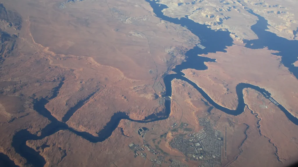
The Colorado River below Glen Canyon Dam is a moving river in a canyon. Lake Powell is a reservoir created by the dam, with a shoreline and access points that change with water level and operations. A river trip, marina departure, shoreline visit, and overlook are not interchangeable “water activities.”

Before a water-based plan, confirm the responsible current conditions, launch or meeting point, equipment and operator requirements, wind and weather, and what happens if conditions change. Do not infer that an old photograph proves current water access. If an activity requires a provider, rely on the final provider instructions rather than an editorial itinerary.
A waterline is also a factual and ethical part of the landscape. Showing exposed rock and changing reservoir extent is not a visual defect. It is more honest than presenting a permanently full turquoise surface as neutral fact.
Read the dam without a triumph-only story
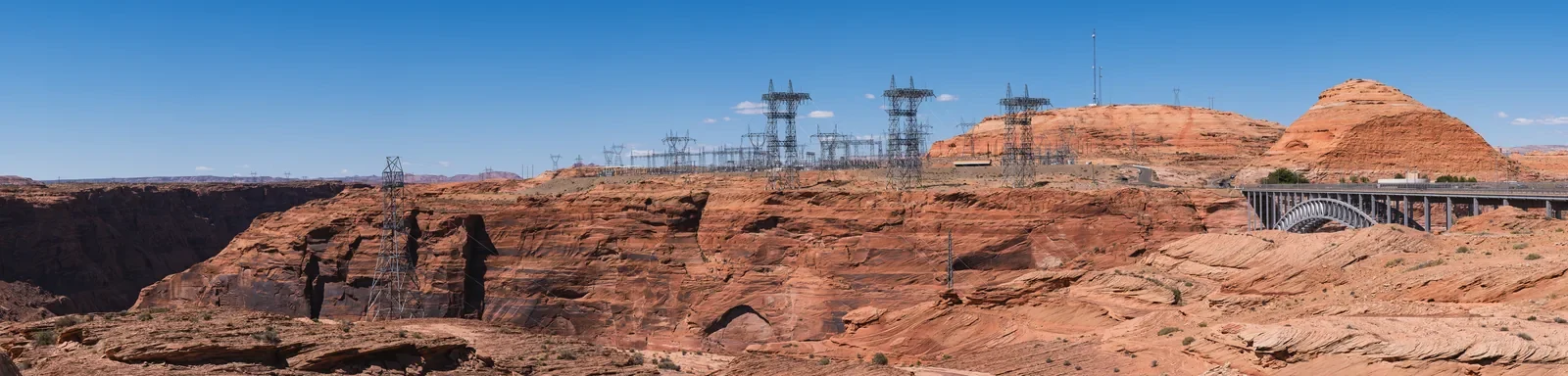
Glen Canyon Dam and bridge are immense engineered structures tied to Page’s founding and to major regional questions about power, water, ecology, archaeology, displacement, recreation, and the altered Colorado River. A guide can explain scale and function without turning concrete into uncomplicated progress.
Use Bureau of Reclamation and National Park Service sources for current visitor access and interpretation. Security restrictions and facility operations can change. Photograph from lawful public areas, obey signs, and do not approach restricted infrastructure for a better angle.

Still comparing Arizona By Context: First Visit City, Federal, Navajo, River, Reservoir Plans?
Ask for tour ideas, hotel suggestions, or a simple trip plan that combines both.
Trip Helper
Keep Page town in a landscape itinerary
Page’s planned grid, downtown businesses, parks, library, public art and events, Rim Trail use, airport edge, schools, services, and everyday routines provide a necessary counterweight to the vast surroundings. Treating the city as a motel row or parking lot erases the community that makes the trip possible.
Choose food and shops because they fit your route and interest, not as tokens representing an entire region or culture. Ask before photographing a worker, maker, vendor, small interior, or person. Do not use Indigenous-made jewelry, art, or design as anonymous “Southwestern” decoration. Learn the maker and terms when work is offered for sale or display.
A quiet downtown or park hour can be the right contrast after exposure. It creates time to check tomorrow’s source, reorganize gear, notice the city’s mesa relationship, and make a less ambitious decision if the conditions call for it.
Choose where to stay by route logic
Live Nuitee hotel inventory is not configured on this site, so this guide does not name or rank a property, quote a price, or imply availability. Instead, compare the needs that will remain relevant when inventory is connected.
- Morning anchor: how early must you reach an authorized meeting point, overlook, road, marina, or visitor facility?
- Return conditions: will you come back after dark, wind, heat, a long drive, or time on the water?
- Access: confirm the property’s actual step-free route, room, parking, service-animal, and communication details directly.
- Practical services: consider food, charging, laundry, refrigerator, gear, parking dimensions, and the needs of children or a group.
- Cancellation: weather and provider changes make the final lodging terms important; read them on the provider page.
A room that shortens the first and last hour can be more useful than one selected from a generic scenic label. Page is compact, but the road, meeting point, parking, and departure context still matter.
Plan heat, wind, cold, and clear air together
High-desert conditions can change by season, elevation, exposure, time of day, and weather system. Bright air does not guarantee mild temperature. A canyon or shaded river corridor can feel different from an open overlook. Wind can alter water and rim plans. Monsoon conditions, winter cold, or intense sun require current information rather than a single climate stereotype.
Carry water and layers appropriate to the most exposed part of the route. Protect skin and eyes. Do not rely on a vehicle as the only emergency plan when leaving it for a trail or guided experience. If smoke, lightning, heat, wind, flooding risk, or another warning affects the day, follow the authority or operator responsible for the place.
Make access a planning field
“Short” and “easy” are incomplete. Useful details include surface, slope, steps, shade, seating, restrooms, noise, crowding, drop-off, parking, barriers, and the reliability of an accessible route. Official access material and direct confirmation are more useful than an adjective.
A guided canyon, overlook, boat, river trip, visitor facility, downtown route, and hotel can each have a different access profile. If an accommodation is essential, confirm it with the responsible operator and keep an alternative. A lower-effort Page town day can be a complete day, not a consolation.

Horseshoe Bend Float Trip in Page
The trip begins in Page, AZ with boarding our bus and driving to Lee’s Ferry. Once at Lee’s Ferry join your guid...

Sunset Horseshoe Bend Off-Road UTV Adventure
Experience the thrill of driving your own UTV through the stunning high desert landscape of Northern Arizona on our...

Both Upper and Lower Antelope Canyon Tours - Arizona Tours
Navajo owned and operated. On this, 4 1/2 hour, half day tour you will see two of the most sought after Canyons in t...
A resilient three-day framework
This is not a fixed itinerary. It is a way to avoid stacking incompatible contexts.
- Day one — orient: Page town, an official source check, one overlook or engineering perspective, and an early return.
- Day two — authorized anchor: one guided or water experience, with the rest of the day kept close to its meeting and return logic.
- Day three — conditions choice: select river, reservoir, trail, town, or indoor interpretation according to current access, weather, energy, and what the first two days clarified.
Remove a day element before adding one. The margin allows a guide’s instructions, changing water access, a slow viewpoint, a meal, or simple fatigue to reshape the plan without causing every later commitment to fail.
Keep road, meeting, and time information explicit
A route around Page can cross long open roads, major recreation areas, and places whose familiar names hide different meeting points. Save the exact street address, parking area, launch, or operator check-in from the responsible current source. Do not rely on a search result pin when a confirmation provides different instructions. Download only the maps you are authorized to use, and keep a plain-text version of the critical location.
Time details deserve the same precision. Read the final confirmation’s local time and arrival requirement rather than making an assumption based on where the day began. Allow for fuel, road work, security or entrance procedures, parking, a restroom, and the walk from a vehicle to the actual check-in. A scheduled start is not the time to enter the parking lot.
Tell someone in your group which source controls each part of the day. If one person has the booking and another has the route, both should know the provider name, meeting point, cancellation contact, and return plan. A screenshot can help when reception is weak, but a screenshot is not permission to ignore a later official alert.
Photograph places without turning them into property
Page’s broad views invite panoramic photography, and guided canyon experiences can be visually intense. The right to see a place does not create an unlimited right to photograph, record, publish, commercialize, or reproduce it. Follow the current land-manager, Nation, operator, venue, property, and guide rules. Ask a person before making them the subject. Keep routes, entrances, work areas, and other visitors clear.
Do not remove the factual waterline, crowd, barrier, guide, infrastructure, or town context merely because a cleaner image fits a preconceived “Southwest” story. Avoid geotagging or describing an unofficial access route. Do not imitate unsafe edge poses or publish a guide’s cultural interpretation as your own discovery.
Make the final evening a planning tool
Return to Page with enough light and energy to make the next day better. Refill water, charge devices, check the vehicle, read updated conditions, and choose breakfast or supplies without a rushed morning detour. If the next anchor is canceled or conditions change, decide the backup while you are rested rather than in a parking area with a deadline.
Before leaving the room or campsite
- Exact responsible source and final confirmation saved.
- Meeting, parking, launch, or trail point—not only a place name.
- Water, layers, sun and wind protection, and needed medication.
- Access requirements and a lower-effort alternative.
- Fuel, return route, daylight, and one person who knows the plan.
Primary source desk
- City of Page for City context.
- National Park Service Horseshoe Bend and Glen Canyon visitor information for current federal public-land conditions.
- Navajo Nation Parks & Recreation and the authorized guide for Navajo-land access.
- Bureau of Reclamation Glen Canyon Dam for engineering and current facility context.
Lower Antelope Canyon Tour Ticket
Lower Antelope Canyon is one the most exquisitely photographed attractions in the Page Lake Powell area. Many visito...
Page Lower Antelope Canyon Prime Time Guided Tour
Discover the world famous Lower Antelope Canyon, one of Arizona's most breathtaking natural wonders. Join a guided...
Page: Lower Antelope Canyon Prime Time Entry with Navajo Guide
Follow your local Navajo guide on a walking tour of the remarkable Lower Antelope Canyon. Explore the canyon's incre...
Page is the stable shelf. The responsible authority, land, water, and conditions determine the route beyond it.


