

Page sits beside two water stories that are often collapsed into one. The Colorado River moves through Glen Canyon below the dam. Lake Powell is a reservoir impounded behind the dam, with a shoreline, ramps, marina access, and navigable routes that change with water level and operations. A good plan begins by naming which water experience you mean.
The river is a moving canyon system
A river trip depends on launch or meeting logistics, current flow and weather, operator rules, equipment, canyon access, and a route that may not resemble a reservoir outing. If a provider controls the experience, follow its final confirmation and the responsible land/water manager. Do not substitute a static editorial schedule.

Lake Powell Kayak and Water Antelope Canyon Hike Guided Tour
Experience one of Lake Powell's highest rated guided kayak adventures, featuring exclusive water access to the breathtaking Water Antelope Canyon. Pro...

Antelope Canyon Lake Powell Guided Kayaking and Hike Tour
This four-hour kayak, hike and swim tour into the sacred Antelope Canyon offers an unforgettable adventure: combinin...

Antelope Canyon Kayak and Hike, Swim optional
We do all the work for you! We carry all kayaks up and down the steep sandy beach for you so your tour is as relaxin...
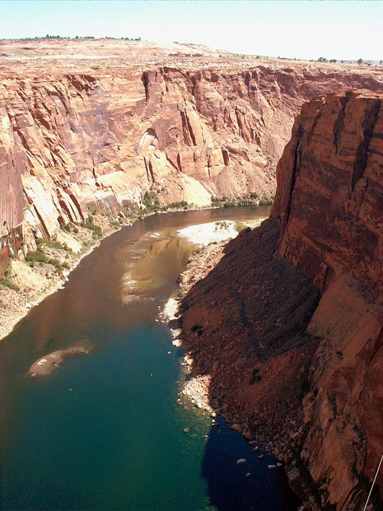
The dam has changed the river’s temperature, sediment, ecology, and flow. Describing the water only as a scenic ribbon omits that engineered context. National Park Service and Bureau of Reclamation materials provide a better foundation for understanding the river below Page.
The reservoir has a variable datum
Lake Powell’s visible rock and access change as the reservoir level changes. Old photographs, maps, memory, and even recent trip reports can mislead a current launch or shoreline decision. Check current National Park Service and responsible concession information for ramps, marinas, closures, navigation, facilities, and safety.

Do not treat exposed “bathtub ring,” shoreline, or changing water extent as something to crop away. The waterline is part of the factual landscape. Avoid promising permanently full turquoise coves or a boat route that current conditions may not support.
Match the access point to the actual activity
“Lake Powell” is not one entrance, marina, ramp, or shore. A provider confirmation may use a specific check-in that differs from a map’s most prominent label. A ramp can have current restrictions; a shoreline seen from an overlook may not be a lawful or practical place to reach the water. Save the exact responsible source and do not infer access from visible roads or tracks.
For paddling, boating, or another equipment-based activity, confirm required safety gear, inspection or permit rules, transport, launch and retrieval, communication, and weather thresholds through the current manager or operator. Do not borrow a checklist from a different reservoir or river.
Keep ecology and cultural history in the water story
Glen Canyon has more than a scenic and engineering history. National Park Service material documents long human presence, continuing tribal relationships, archaeology, habitats, hanging gardens, and landscapes altered by inundation and reservoir fluctuation. A water itinerary does not need to resolve the region’s complex debates, but it should not describe the pre-dam canyon as empty or the present reservoir as timeless.
Stay out of closed or protected areas, do not remove artifacts or natural material, and follow rules concerning archaeological and cultural sites. Do not publish a sensitive location simply because it is visible from the water.
Use an overlook when direct water access does not fit
A reservoir overlook or bridge/dam perspective can clarify the waterline and scale without requiring a boat or shore approach. This can be the better choice for time, mobility, weather, budget, or comfort. Verify the overlook’s current access and do not promise it as universally step-free or open.
Wind and weather can redefine the day
Broad water and canyon terrain can respond quickly to wind, storms, heat, cold, and visibility. Use forecasts and on-site guidance appropriate to the exact location. Carry water and protective layers even when the town feels calm. A provider cancellation or land-manager warning is not a suggestion to seek an unapproved alternative route.
Read the engineered threshold
Glen Canyon Dam and bridge connect Page’s founding, regional power and water systems, recreation, environmental change, archaeology, and the altered river. Their size is visually compelling, but the story should not be reduced to engineering triumph. Use current Bureau of Reclamation and National Park Service interpretation and obey infrastructure security restrictions.


Horseshoe Bend Float Trip in Page
The trip begins in Page, AZ with boarding our bus and driving to Lee’s Ferry. Once at Lee’s Ferry join your guid...

Lower Antelope Canyon General Guided Tour
The Navajo name for Lower Antelope Canyon is Hasdeztwazi or “Spiral Rock Arches.” This incredible canyon has bee...

Three Canyon Photography Tour in Page Arizona
Capture the stunning beauty of Mountain Sheep Canyon, Rattlesnake Canyon, and Owl Canyon on this exclusive photograp...
A practical choice matrix
- Choose a river context when the moving-water experience, canyon corridor, and authorized launch/guide are the anchor.
- Choose a reservoir context when current marina, ramp, shore, or boat access is confirmed and fits the weather.
- Choose an overlook when you want orientation without promising water access.
- Choose town or interpretation when wind, heat, access, or energy makes an exposed water plan unwise.
Current sources

Upper Antelope Canyon Prime Time Entry with Navajo Guide
Discover the Upper Antelope Canyon on this guided walking tour. Enjoy a scenic ride to the canyon before venturing o...

Antelope Wind Canyon Slot Tours
Embark on an unforgettable adventure with Wind Canyon Tours, where you'll explore the breathtaking beauty of Wind Ca...

Upper Antelope Canyon Hiking Tour
This is an all-hiking tour that begins at our location and takes you to Upper Antelope Canyon. Covering a 4 mile in...
Lake Powell Kayak and Water Antelope Canyon Hike Guided Tour
Experience one of Lake Powell's highest rated guided kayak adventures, featuring exclusive water access to the breathtaking Water Antelope Canyon. Pro...
Antelope Canyon Lake Powell Guided Kayaking and Hike Tour
This four-hour kayak, hike and swim tour into the sacred Antelope Canyon offers an unforgettable adventure: combinin...
Antelope Canyon Kayak and Hike, Swim optional
We do all the work for you! We carry all kayaks up and down the steep sandy beach for you so your tour is as relaxin...
Use Glen Canyon National Recreation Area visitor information and Bureau of Reclamation Glen Canyon Dam information. Follow the final authorized operator instructions for a guided or booked experience.
